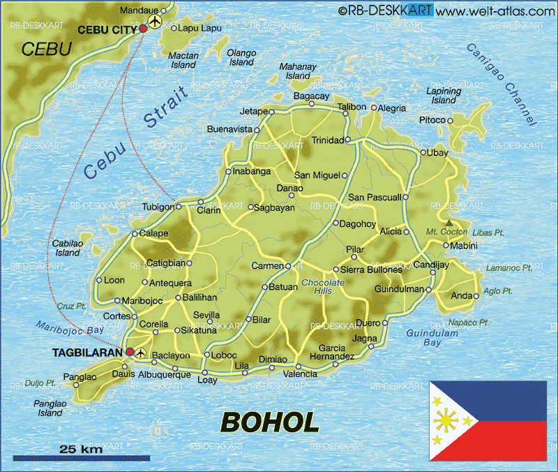
MAP OF BOHOL
Bohol is an island
province of the Philippines located in the Central Visayas region,
consisting of Bohol Island and 75 minor surrounding islands. Its
capital is Tagbilaran City. With a land area of 4,117.3 square
kilometers (1,589.7 sq mi) and a coastline 261 kilometers (162 mi)
long, Bohol is the tenth largest island of the Philippines. To the
west of Bohol is Cebu, to the northeast is the island of Leyte and to
the south, across the Bohol Sea is Mindanao.
The province is a popular tourist destination with its beaches and
resorts. The Chocolate Hills, numerous mounds of limestone formation,
is the most popular attraction. The island of Panglao, located just
southwest of Tagbilaran City, is famous for its diving locations and
routinely listed as one of the top ten diving locations in the world.
Numerous tourist resorts dot the southern beaches and cater to divers
from around the world. The Philippine Tarsier, considered the
second-smallest primate in the world, is indigenous to the island.
Boholanos refer to their island homeland as the "Republic of Bohol"
with both conviction and pride. A narrow strait separates the island of
Cebu and Bohol and both share a common language, but the Boholanos
retain a conscious distinction from the Cebuanos. Bohol's climate is
generally dry, with maximum rainfall between the months of June and
October. The interior is cooler than the coast.
It is the home province of Carlos P. Garcia, the fourth president of
the Republic of the Philippines (1957-1961) who was born in Talibon,
Bohol.